Yucatán Cenote Coast
Riviera Maya & Puuc (Yucatán / Quintana Roo)
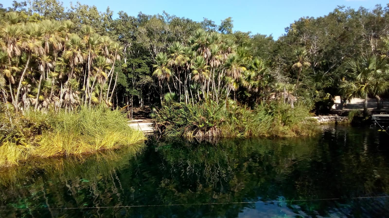
Cool limestone pools open beneath jungle canopy; light shafts cut the water like columns. Evenings move from reef swim to limestone ruins warm with stone.
- Days
- 8
- Effort
- Easy
- Window
- Nov–Apr
- From
- $5,200
The ground
The whole peninsula is one limestone slab with no surface rivers. Rain sinks straight through it into a flooded cave system, and cenotes are simply the places where the roof has fallen in. Some are open pools with light shafts cutting the water into columns; others are closed chambers you enter by ladder, where the halocline sits as a visible blur between fresh and salt.
The Puuc route inland is the counterweight to the coast: Uxmal, Kabah, Sayil, and Labná, built in a style that used no cenote at all. Those cities ran on chultunes, hand-cut cisterns, because the water table there is too deep to reach.
Riviera Maya and the Puuc region, spanning Quintana Roo and Yucatán states. Working elevation runs Sea level; Puuc hills to about 150 m. That profile shapes sleep, pace, and how early the group needs to move. The published window: November through April: dry, outside hurricane season, and clear of the sargassum window. Within that window, day order still flexes with weather and access.
Many of the best cenotes sit on ejido or private land and are entered by arrangement rather than ticket. Sunscreen is prohibited at most of them; we supply reef-safe alternatives or ask you to swim without. Uxmal and the Puuc sites are far quieter than Chichén Itzá and we plan around opening time deliberately. Private guide and vehicle throughout, with a cenote specialist for the cave and cavern sites. Small-group departures up to eight. This is the operating shape of the trip: private enough to reorder days, constrained enough that permits and local rules still set the ceiling.
Shape of the days
A shape, not a script. Order and pacing move with weather, permits, and how the first days actually go.
Day 1
Arrival and first cenotes: opening
Day 1 sits inside the 1–2 arc titled Arrival and first cenotes. Into Cancún or Tulum, then straight inland away from the coast road. Open and cavern cenotes around Homún and Cuzamá, dived or snorkelled depending on your comfort. This opening slice sets the logistics and the first read of the ground before the denser days. Arrival and orientation use the published access picture. Many of the best cenotes sit on ejido or private land and are entered by arrangement rather than ticket. Sunscreen is prohibited at most of them; we supply reef-safe alternatives or ask you to swim without. Elevation context for the programme: Sea level; Puuc hills to about 150 m. Sleep and walk length are graded against that, not against a generic fitness brochure. Early days protect the later ones. We do not burn the group on a full-length day before the body has met the altitude, heat, or boat rhythm this route actually uses. The Puuc route inland is the counterweight to the coast: Uxmal, Kabah, Sayil, and Labná, built in a style that used no cenote at all. Those cities ran on chultunes, hand-cut cisterns, because the water table there is too deep to reach. Geography stays inside Riviera Maya and the Puuc region, spanning Quintana Roo and Yucatán states. Season logic we plan against: November through April: dry, outside hurricane season, and clear of the sargassum window. Packing still matters here: Swim kit you can put on wet, water shoes for limestone, and a towel that dries.
Day 2
Arrival and first cenotes: continuation
Day 2 sits inside the 1–2 arc titled Arrival and first cenotes. Into Cancún or Tulum, then straight inland away from the coast road. Open and cavern cenotes around Homún and Cuzamá, dived or snorkelled depending on your comfort. This closing slice of the block consolidates what the earlier days opened, without inventing a new sector. Arrival and orientation use the published access picture. Uxmal and the Puuc sites are far quieter than Chichén Itzá and we plan around opening time deliberately. Elevation context for the programme: Sea level; Puuc hills to about 150 m. Sleep and walk length are graded against that, not against a generic fitness brochure. Early days protect the later ones. We do not burn the group on a full-length day before the body has met the altitude, heat, or boat rhythm this route actually uses. Those cities ran on chultunes, hand-cut cisterns, because the water table there is too deep to reach. Geography stays inside Riviera Maya and the Puuc region, spanning Quintana Roo and Yucatán states. Season logic we plan against: November through April: dry, outside hurricane season, and clear of the sargassum window. Packing still matters here: Swim kit you can put on wet, water shoes for limestone, and a towel that dries.
Day 3
Reef: opening
Day 3 sits inside the 3–4 arc titled Reef. Snorkel or dive the Mesoamerican reef off Puerto Morelos or Akumal, with green turtles on the sea-grass beds in the early morning before boat traffic. This opening slice sets the logistics and the first read of the ground before the denser days. Field days stay inside the ground already described for Mexico. The whole peninsula is one limestone slab with no surface rivers. Many of the best cenotes sit on ejido or private land and are entered by arrangement rather than ticket. Sunscreen is prohibited at most of them; we supply reef-safe alternatives or ask you to swim without. Private guide and vehicle throughout, with a cenote specialist for the cave and cavern sites. Expect a full field day measured in hours on foot, on the water, or in transit between sectors already named above. Private guiding means we can shorten or reorder, not that the underlying constraints disappear. The Puuc route inland is the counterweight to the coast: Uxmal, Kabah, Sayil, and Labná, built in a style that used no cenote at all. Those cities ran on chultunes, hand-cut cisterns, because the water table there is too deep to reach. Geography stays inside Riviera Maya and the Puuc region, spanning Quintana Roo and Yucatán states. Season logic we plan against: November through April: dry, outside hurricane season, and clear of the sargassum window. For kit on these days: Swim kit you can put on wet, water shoes for limestone, and a towel that dries.
Day 4
Reef: continuation
Day 4 sits inside the 3–4 arc titled Reef. Snorkel or dive the Mesoamerican reef off Puerto Morelos or Akumal, with green turtles on the sea-grass beds in the early morning before boat traffic. This closing slice of the block consolidates what the earlier days opened, without inventing a new sector. Field days stay inside the ground already described for Mexico. The Puuc route inland is the counterweight to the coast: Uxmal, Kabah, Sayil, and Labná, built in a style that used no cenote at all. Uxmal and the Puuc sites are far quieter than Chichén Itzá and we plan around opening time deliberately. Private guide and vehicle throughout, with a cenote specialist for the cave and cavern sites. Expect a full field day measured in hours on foot, on the water, or in transit between sectors already named above. Private guiding means we can shorten or reorder, not that the underlying constraints disappear. Those cities ran on chultunes, hand-cut cisterns, because the water table there is too deep to reach. Geography stays inside Riviera Maya and the Puuc region, spanning Quintana Roo and Yucatán states. Season logic we plan against: November through April: dry, outside hurricane season, and clear of the sargassum window. For kit on these days: Swim kit you can put on wet, water shoes for limestone, and a towel that dries.
Days 5–6
Puuc and Mérida: opening
Days 5–6 continue the Puuc and Mérida block. Uxmal at opening and the smaller Puuc sites when they are empty, hacienda nights, and Mérida's markets and Yucatecan kitchens. This opening slice sets the logistics and the first read of the ground before the denser days. Field days stay inside the ground already described for Mexico. The whole peninsula is one limestone slab with no surface rivers. Many of the best cenotes sit on ejido or private land and are entered by arrangement rather than ticket. Sunscreen is prohibited at most of them; we supply reef-safe alternatives or ask you to swim without. Private guide and vehicle throughout, with a cenote specialist for the cave and cavern sites. Expect a full field day measured in hours on foot, on the water, or in transit between sectors already named above. Private guiding means we can shorten or reorder, not that the underlying constraints disappear. The Puuc route inland is the counterweight to the coast: Uxmal, Kabah, Sayil, and Labná, built in a style that used no cenote at all. Those cities ran on chultunes, hand-cut cisterns, because the water table there is too deep to reach. Geography stays inside Riviera Maya and the Puuc region, spanning Quintana Roo and Yucatán states. Season logic we plan against: November through April: dry, outside hurricane season, and clear of the sargassum window. For kit on these days: Swim kit you can put on wet, water shoes for limestone, and a towel that dries.
Day 7
Puuc and Mérida: continuation
Day 7 sits inside the 5–7 arc titled Puuc and Mérida. Uxmal at opening and the smaller Puuc sites when they are empty, hacienda nights, and Mérida's markets and Yucatecan kitchens. This closing slice of the block consolidates what the earlier days opened, without inventing a new sector. Field days stay inside the ground already described for Mexico. The Puuc route inland is the counterweight to the coast: Uxmal, Kabah, Sayil, and Labná, built in a style that used no cenote at all. Uxmal and the Puuc sites are far quieter than Chichén Itzá and we plan around opening time deliberately. Private guide and vehicle throughout, with a cenote specialist for the cave and cavern sites. Expect a full field day measured in hours on foot, on the water, or in transit between sectors already named above. Private guiding means we can shorten or reorder, not that the underlying constraints disappear. Those cities ran on chultunes, hand-cut cisterns, because the water table there is too deep to reach. Geography stays inside Riviera Maya and the Puuc region, spanning Quintana Roo and Yucatán states. Season logic we plan against: November through April: dry, outside hurricane season, and clear of the sargassum window. For kit on these days: Swim kit you can put on wet, water shoes for limestone, and a towel that dries.
Day 8
Exit
Day 8 sits inside the 8 arc titled Exit. Coastal or Mérida departure. The day order inside this block can shift when weather or access forces a rewrite. Exit logistics follow the same transfer pattern already built into the programme. Uxmal and the Puuc sites are far quieter than Chichén Itzá and we plan around opening time deliberately. International connections should leave buffer after the last field day; late-evening flights only when the ground day is genuinely short. The last day is deliberately lighter where the catalogue allows it, so extraction does not collide with a hard physical ask. The Puuc route inland is the counterweight to the coast: Uxmal, Kabah, Sayil, and Labná, built in a style that used no cenote at all. Those cities ran on chultunes, hand-cut cisterns, because the water table there is too deep to reach. Geography stays inside Riviera Maya and the Puuc region, spanning Quintana Roo and Yucatán states. Season logic we plan against: November through April: dry, outside hurricane season, and clear of the sargassum window. Packing still matters here: Swim kit you can put on wet, water shoes for limestone, and a towel that dries.
Conditions
Warm all year, 26–33 °C. November to April is dry and breezy. Hurricane season runs June to November. Sargassum washes onto the open Caribbean coast roughly April to October, peaking June to August, cenotes, Bacalar, and the sheltered west side of Cozumel are unaffected, which is one reason we weight the itinerary inland.
Fitness bar
Easy. Swimming, ladder descents into cenotes, and walking on uneven archaeological ground in heat.
Best months
November through April: dry, outside hurricane season, and clear of the sargassum window.
Private or small group
Private guide and vehicle throughout, with a cenote specialist for the cave and cavern sites. Small-group departures up to eight.
What to bring
Swim kit you can put on wet, water shoes for limestone, and a towel that dries. Sunscreen is prohibited at most cenotes, so bring a rash vest instead or plan to swim without. A light layer for cool cavern water.
Mesoamerica
Access and permits
The constraints that actually decide whether a date is possible.
- Many of the best cenotes sit on ejido or private land and are entered by arrangement rather than ticket. Sunscreen is prohibited at most of them; we supply reef-safe alternatives or ask you to swim without.
- Uxmal and the Puuc sites are far quieter than Chichén Itzá and we plan around opening time deliberately.
Included
- Cenote entries, including private-access sites on ejido land
- Archaeological site tickets and a licensed site guide
- Reef snorkel or dive with marine park fees
- Hacienda and boutique lodging, private transfers
- Daily field briefings with the lead guide before departure
Not included
- International flights
- Cave-diving certification courses
- Beach days on the open coast in sargassum season, which we will not pretend are reliable
- Personal insurance, including medical and evacuation cover
- Tips for guides and lodge staff, which remain optional and separate
What the price reflects
$5,200–7,800 for eight days private is in line with high-end hacienda and boutique villa rates on the peninsula, with private guiding and private cenote access. Group day-tours from Cancún cost a fraction and deliver a fundamentally different day. What moves a quote inside that picture is party size, season, and the lodge or camp class actually available for your dates. Private guide and vehicle throughout, with a cenote specialist for the cave and cavern sites. Small-group departures up to eight. On the included side, the band already assumes items such as: Cenote entries, including private-access sites on ejido land; Archaeological site tickets and a licensed site guide; Reef snorkel or dive with marine park fees. Still outside the band unless we write them in: International flights; Cave-diving certification courses; Beach days on the open coast in sargassum season, which we will not pretend are reliable. Nothing is confirmed until it is confirmed in writing.
- Party size
- Per-person cost usually falls as the private team is shared across more guests, up to the format limit implied by the guiding and lodge picture. Private guide and vehicle throughout, with a cenote specialist for the cave and cavern sites.
- Season and dates
- Window on the card: Nov–Apr. Planning note: November through April: dry, outside hurricane season, and clear of the sargassum window. Peak dates inside that window tighten lodge and permit availability, which is what usually pushes a quote toward the top of a published band.
- Lodge or camp class
- Where you sleep (lodge, tented camp, or station) is one of the largest levers once guiding is fixed. We price the class we can actually hold for your dates.
- Internal transport
- Transfers and regional legs follow the trip design. Watch for: International flights. Charter or peak-season domestic seats, where they apply, sit outside a simple road transfer.
- Permits and access
- Access cost tracks what the ground already requires. Cenote entries, including private-access sites on ejido land We do not invent fee figures beyond what the catalogue already states.
- Outside the band
- Not assumed unless written in: International flights; Cave-diving certification courses; Beach days on the open coast in sargassum season, which we will not pretend are reliable.
Bands are per person sharing and move with party size, season, and lodge choice. Nothing is confirmed until it is confirmed in writing. How we price.
Where this is
Riviera Maya and the Puuc region, spanning Quintana Roo and Yucatán states.
Elevation: Sea level; Puuc hills to about 150 m. Season as published: Nov–Apr. Difficulty as assessed: Easy.
What we checked
Seasons, altitudes, permits, and caps on this page were checked against park authorities, monitoring agencies, and operators on the ground. Where a fact changes with the year, we say so rather than round it off.
Near this
Same terrain, different week
Mexico
Copper Canyon Traverse
Sierra Tarahumara / Barrancas del Cobre (Chihuahua)
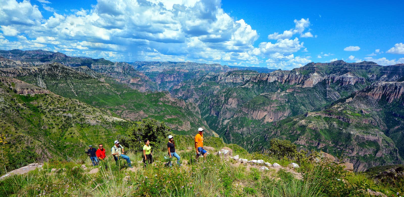
Several gorges here run deeper than the Grand Canyon, folded into pine and cliff. Footpaths follow Rarámuri routes where the rim drops away without warning.
- Duration
- 10 days
- Effort
- Challenging
- Window
- Oct–Apr
$6,500–$9,200
Detail →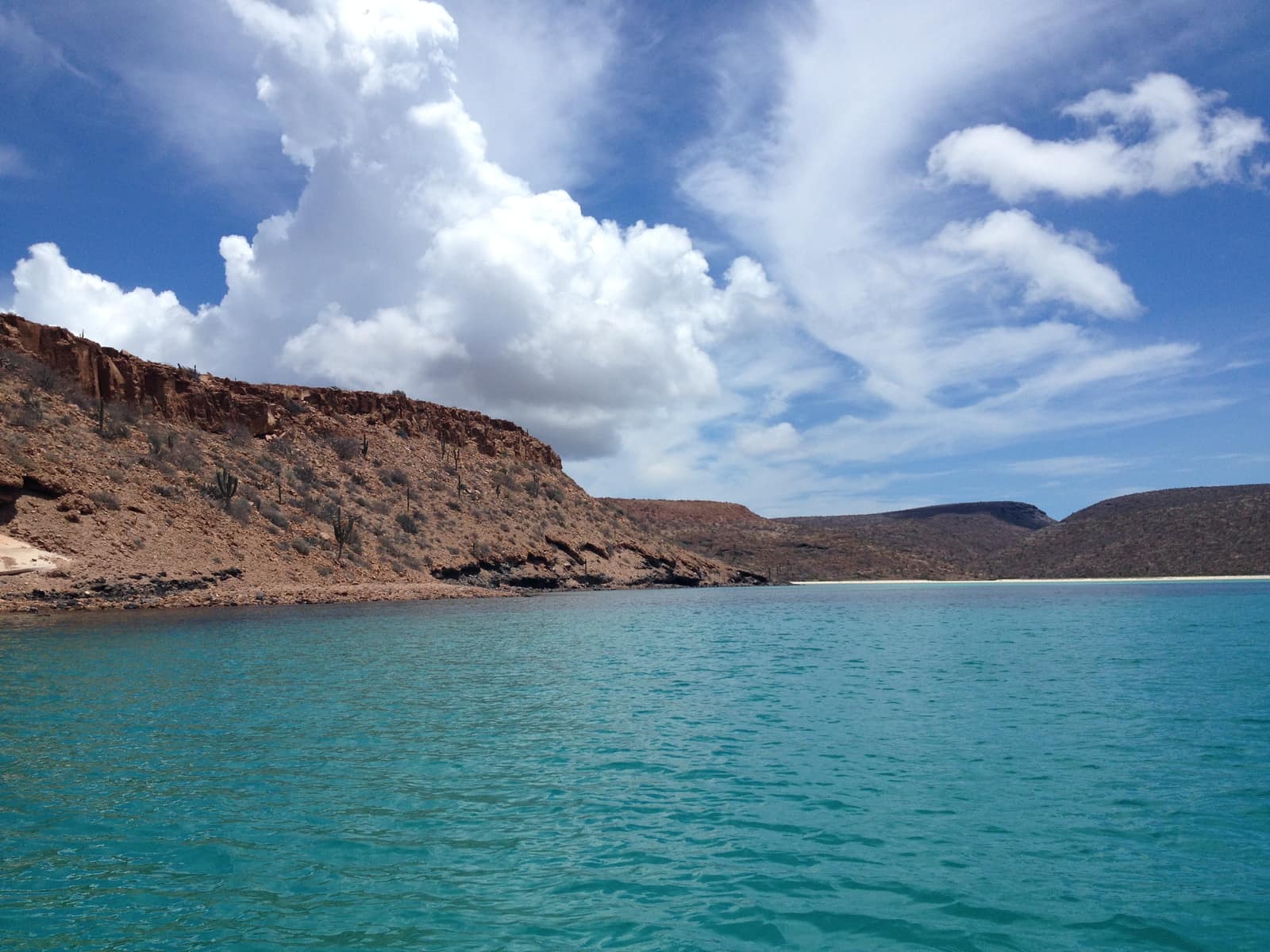
Mexico
Baja Sea of Cortez Crossing
Loreto to La Paz
Kayak past sea lions on desert islands while whale breath plumes the channel. Camp on beaches where the desert meets deep blue water.
- Duration
- 9 days
- Effort
- Moderate
- Window
- Oct–Nov & Mar–Apr
$7,800–$11,200
Detail →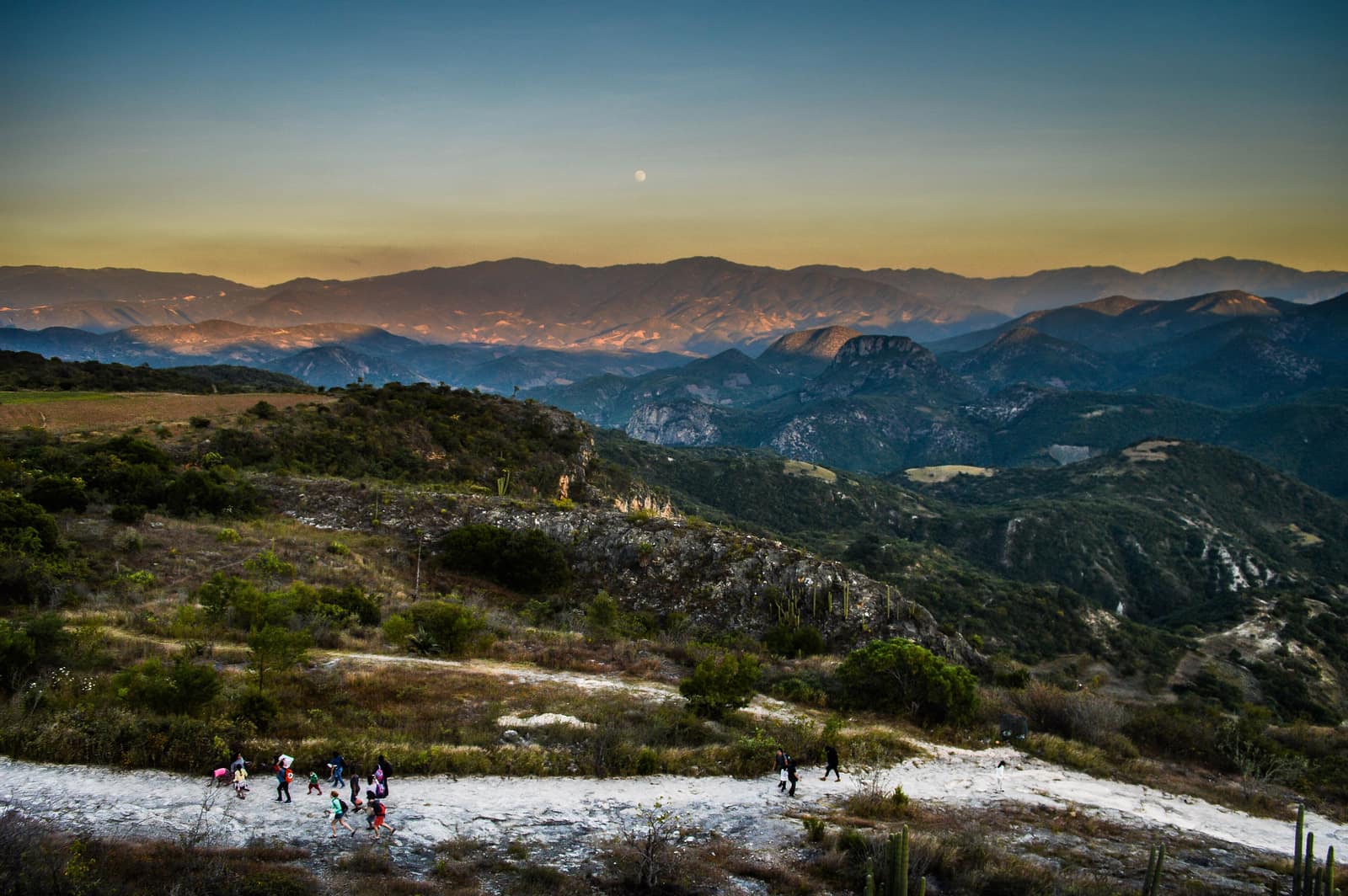
Mexico
Oaxaca Highland Ascent
Sierra Norte & Central Valleys
Cloud forest trails link Zapotec villages where smoke from cooking fires rises at dusk. Ridges open onto valleys quilted with maize and agave.
- Duration
- 8 days
- Effort
- Moderate
- Window
- Oct–Mar
$4,800–$7,200
Detail →From the ground
Frames from this route family and country — not a studio set, and not a promise of identical weather.