Oaxaca Highland Ascent
Sierra Norte & Central Valleys
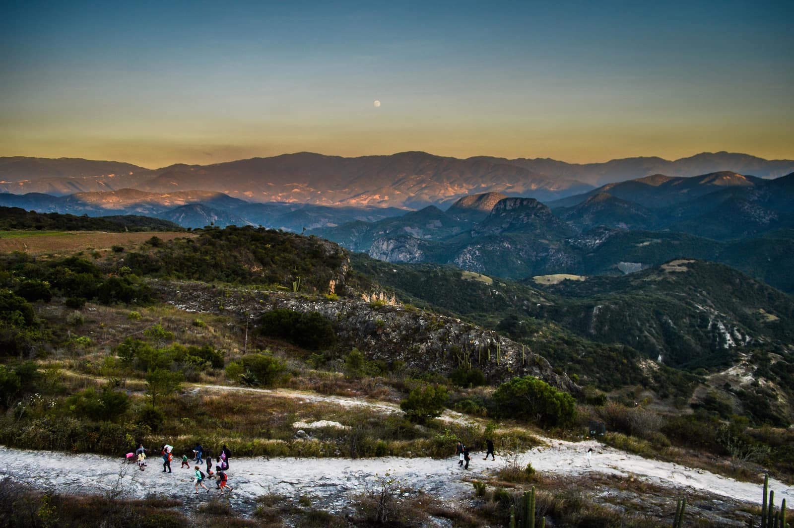
Cloud forest trails link Zapotec villages where smoke from cooking fires rises at dusk. Ridges open onto valleys quilted with maize and agave.
- Days
- 8
- Effort
- Moderate
- Window
- Oct–Mar
- From
- $4,800
The ground
The Sierra Norte is one of the most biodiverse temperate forests in the Americas and it is owned and run by the villages themselves. The Pueblos Mancomunados, Benito Juárez, Cuajimoloyas, Latuvi, Lachatao and their neighbours, hold the land communally and manage the trail network, cabins, and guiding as community enterprises. You are walking on Zapotec commons, and the fees go to the village whose trail you used.
The walking links pine-oak ridge at 3,200 m down through cloud forest to the coffee terraces at Latuvi, on paths that were pre-Hispanic trade routes long before they were anything else. Mornings are cold and clear; the cloud comes up the valley most afternoons.
Down in the valleys, the food and the mezcal are not a garnish on the trip. The palenques above Santiago Matatlán and the market kitchens in Tlacolula are as much the point as the ridges.
Sierra Norte de Oaxaca and the Central Valleys. Zapotec communal territory. Working elevation runs Oaxaca city 1,555 m · Sierra Norte villages 2,200–3,200 m. That profile shapes sleep, pace, and how early the group needs to move. The published window: October through March, dry and clear. October still carries green from the rains; February and March are the driest. Within that window, day order still flexes with weather and access.
Community guides are mandatory on the Pueblos Mancomunados network, that is the communities' rule, not a service upsell, and it is how the enterprise funds itself. Village cabins are simple, warm, and clean. They are not lodges, and we would rather you knew that before you arrive. Private, with a comunero guide from each village alongside your lead guide. Small-group departures up to ten. This is the operating shape of the trip: private enough to reorder days, constrained enough that permits and local rules still set the ceiling.
Shape of the days
A shape, not a script. Order and pacing move with weather, permits, and how the first days actually go.
Day 1
Oaxaca city: opening
Day 1 sits inside the 1–2 arc titled Oaxaca city. Markets, the Centro Histórico, Monte Albán early, and dinner with the cooks who actually run those kitchens. This opening slice sets the logistics and the first read of the ground before the denser days. Field days stay inside the ground already described for Mexico. The Sierra Norte is one of the most biodiverse temperate forests in the Americas and it is owned and run by the villages themselves. Community guides are mandatory on the Pueblos Mancomunados network, that is the communities' rule, not a service upsell, and it is how the enterprise funds itself. Private, with a comunero guide from each village alongside your lead guide. Expect a full field day measured in hours on foot, on the water, or in transit between sectors already named above. Private guiding means we can shorten or reorder, not that the underlying constraints disappear. The walking links pine-oak ridge at 3,200 m down through cloud forest to the coffee terraces at Latuvi, on paths that were pre-Hispanic trade routes long before they were anything else. Mornings are cold and clear; the cloud comes up the valley most afternoons. Geography stays inside Sierra Norte de Oaxaca and the Central Valleys. Zapotec communal territory. Season logic we plan against: October through March, dry and clear. October still carries green from the rains; February and March are the driest. For kit on these days: Layers for near-freezing nights above 3,000 m and mild afternoons in the valleys.
Day 2
Oaxaca city: continuation
Day 2 sits inside the 1–2 arc titled Oaxaca city. Markets, the Centro Histórico, Monte Albán early, and dinner with the cooks who actually run those kitchens. This closing slice of the block consolidates what the earlier days opened, without inventing a new sector. Field days stay inside the ground already described for Mexico. The walking links pine-oak ridge at 3,200 m down through cloud forest to the coffee terraces at Latuvi, on paths that were pre-Hispanic trade routes long before they were anything else. Village cabins are simple, warm, and clean. They are not lodges, and we would rather you knew that before you arrive. Private, with a comunero guide from each village alongside your lead guide. Expect a full field day measured in hours on foot, on the water, or in transit between sectors already named above. Private guiding means we can shorten or reorder, not that the underlying constraints disappear. Mornings are cold and clear; the cloud comes up the valley most afternoons. Geography stays inside Sierra Norte de Oaxaca and the Central Valleys. Zapotec communal territory. Season logic we plan against: October through March, dry and clear. October still carries green from the rains; February and March are the driest. For kit on these days: Layers for near-freezing nights above 3,000 m and mild afternoons in the valleys.
Days 3–4
Sierra Norte village to village: opening
Days 3–4 continue the Sierra Norte village to village block. Cuajimoloyas to Latuvi to Lachatao on the community trail network, sleeping in village cabins, walking with a comunero guide from each stage. This opening slice sets the logistics and the first read of the ground before the denser days. Field days stay inside the ground already described for Mexico. Down in the valleys, the food and the mezcal are not a garnish on the trip. Community guides are mandatory on the Pueblos Mancomunados network, that is the communities' rule, not a service upsell, and it is how the enterprise funds itself. Private, with a comunero guide from each village alongside your lead guide. Expect a full field day measured in hours on foot, on the water, or in transit between sectors already named above. Private guiding means we can shorten or reorder, not that the underlying constraints disappear. The Sierra Norte is one of the most biodiverse temperate forests in the Americas and it is owned and run by the villages themselves. The Pueblos Mancomunados, Benito Juárez, Cuajimoloyas, Latuvi, Lachatao and their neighbours, hold the land communally and manage the trail network, cabins, and guiding as community enterprises. You are walking on Zapotec commons, and the fees go to the village whose trail you used. Geography stays inside Sierra Norte de Oaxaca and the Central Valleys. Zapotec communal territory. Season logic we plan against: October through March, dry and clear. October still carries green from the rains; February and March are the driest. For kit on these days: Layers for near-freezing nights above 3,000 m and mild afternoons in the valleys.
Days 5–6
Sierra Norte village to village: continuation
Days 5–6 continue the Sierra Norte village to village block. Cuajimoloyas to Latuvi to Lachatao on the community trail network, sleeping in village cabins, walking with a comunero guide from each stage. This closing slice of the block consolidates what the earlier days opened, without inventing a new sector. Field days stay inside the ground already described for Mexico. The Sierra Norte is one of the most biodiverse temperate forests in the Americas and it is owned and run by the villages themselves. Village cabins are simple, warm, and clean. They are not lodges, and we would rather you knew that before you arrive. Private, with a comunero guide from each village alongside your lead guide. Expect a full field day measured in hours on foot, on the water, or in transit between sectors already named above. Private guiding means we can shorten or reorder, not that the underlying constraints disappear. The Pueblos Mancomunados, Benito Juárez, Cuajimoloyas, Latuvi, Lachatao and their neighbours, hold the land communally and manage the trail network, cabins, and guiding as community enterprises. You are walking on Zapotec commons, and the fees go to the village whose trail you used. Geography stays inside Sierra Norte de Oaxaca and the Central Valleys. Zapotec communal territory. Season logic we plan against: October through March, dry and clear. October still carries green from the rains; February and March are the driest. For kit on these days: Layers for near-freezing nights above 3,000 m and mild afternoons in the valleys.
Day 7
Central valleys
Day 7 sits inside the 7 arc titled Central valleys. Teotitlán weavers on their own terms, a working palenque, and Tlacolula market if the day lands on a Sunday. The day order inside this block can shift when weather or access forces a rewrite. Field days stay inside the ground already described for Mexico. The walking links pine-oak ridge at 3,200 m down through cloud forest to the coffee terraces at Latuvi, on paths that were pre-Hispanic trade routes long before they were anything else. Community guides are mandatory on the Pueblos Mancomunados network, that is the communities' rule, not a service upsell, and it is how the enterprise funds itself. Private, with a comunero guide from each village alongside your lead guide. Expect a full field day measured in hours on foot, on the water, or in transit between sectors already named above. Private guiding means we can shorten or reorder, not that the underlying constraints disappear. Down in the valleys, the food and the mezcal are not a garnish on the trip. The palenques above Santiago Matatlán and the market kitchens in Tlacolula are as much the point as the ridges. Geography stays inside Sierra Norte de Oaxaca and the Central Valleys. Zapotec communal territory. Season logic we plan against: October through March, dry and clear. October still carries green from the rains; February and March are the driest. For kit on these days: Layers for near-freezing nights above 3,000 m and mild afternoons in the valleys.
Day 8
Exit
Day 8 sits inside the 8 arc titled Exit. Oaxaca departure. The day order inside this block can shift when weather or access forces a rewrite. Exit logistics follow the same transfer pattern already built into the programme. Community guides are mandatory on the Pueblos Mancomunados network, that is the communities' rule, not a service upsell, and it is how the enterprise funds itself. International connections should leave buffer after the last field day; late-evening flights only when the ground day is genuinely short. The last day is deliberately lighter where the catalogue allows it, so extraction does not collide with a hard physical ask. The Sierra Norte is one of the most biodiverse temperate forests in the Americas and it is owned and run by the villages themselves. The Pueblos Mancomunados, Benito Juárez, Cuajimoloyas, Latuvi, Lachatao and their neighbours, hold the land communally and manage the trail network, cabins, and guiding as community enterprises. You are walking on Zapotec commons, and the fees go to the village whose trail you used. Geography stays inside Sierra Norte de Oaxaca and the Central Valleys. Zapotec communal territory. Season logic we plan against: October through March, dry and clear. October still carries green from the rains; February and March are the driest. Packing still matters here: Layers for near-freezing nights above 3,000 m and mild afternoons in the valleys.
Conditions
Dry season days 18–25 °C in the valleys, 10–18 °C on the ridges, and near freezing at night above 3,000 m in December and January. Rain concentrates June to September.
Fitness bar
Moderate. Four to six hours a day at 2,200–3,200 m with 400–700 m of ascent, on good village trails. Altitude is mild but real.
Best months
October through March, dry and clear. October still carries green from the rains; February and March are the driest.
Private or small group
Private, with a comunero guide from each village alongside your lead guide. Small-group departures up to ten.
What to bring
Layers for near-freezing nights above 3,000 m and mild afternoons in the valleys. Walking boots for village trails, and cash for the community trail and guide fees, which are paid to each village directly.
Mesoamerica
Access and permits
The constraints that actually decide whether a date is possible.
- Community guides are mandatory on the Pueblos Mancomunados network, that is the communities' rule, not a service upsell, and it is how the enterprise funds itself.
- Village cabins are simple, warm, and clean. They are not lodges, and we would rather you knew that before you arrive.
Included
- Pueblos Mancomunados trail and guide fees paid to each community
- Village cabin accommodation and city hotel nights
- All ground transport and luggage transfer between villages
- Cooking, weaving, and mezcal visits with the makers
- Daily field briefings with the lead guide before departure
Not included
- International flights
- Alcohol beyond tastings
- Oaxaca coast extension
- Personal insurance, including medical and evacuation cover
- Tips for guides and lodge staff, which remain optional and separate
What the price reflects
$4,800–7,200 for eight days is elevated for Oaxaca and buys private guiding, the better city hotels, luggage transfer between villages, and access arranged directly with makers rather than through a shop. The community-run trekking itself is inexpensive and we are transparent about that split. What moves a quote inside that picture is party size, season, and the lodge or camp class actually available for your dates. Private, with a comunero guide from each village alongside your lead guide. Small-group departures up to ten. On the included side, the band already assumes items such as: Pueblos Mancomunados trail and guide fees paid to each community; Village cabin accommodation and city hotel nights; All ground transport and luggage transfer between villages. Still outside the band unless we write them in: International flights; Alcohol beyond tastings; Oaxaca coast extension. Nothing is confirmed until it is confirmed in writing.
- Party size
- Per-person cost usually falls as the private team is shared across more guests, up to the format limit implied by the guiding and lodge picture. Private, with a comunero guide from each village alongside your lead guide.
- Season and dates
- Window on the card: Oct–Mar. Planning note: October through March, dry and clear. October still carries green from the rains; February and March are the driest. Peak dates inside that window tighten lodge and permit availability, which is what usually pushes a quote toward the top of a published band.
- Lodge or camp class
- Accommodation in the band reflects: Village cabin accommodation and city hotel nights. Moving up or down a class, or shifting to a scarcer property, changes the quote without changing the route.
- Internal transport
- Transfers and regional legs follow the trip design. Watch for: International flights. Charter or peak-season domestic seats, where they apply, sit outside a simple road transfer.
- Guiding ratio
- Private, with a comunero guide from each village alongside your lead guide. A dedicated lead, specialist, or community guide changes the quote relative to a shared departure even when the route looks identical on a map.
- Outside the band
- Not assumed unless written in: International flights; Alcohol beyond tastings; Oaxaca coast extension.
Bands are per person sharing and move with party size, season, and lodge choice. Nothing is confirmed until it is confirmed in writing. How we price.
Where this is
Sierra Norte de Oaxaca and the Central Valleys. Zapotec communal territory.
Elevation: Oaxaca city 1,555 m · Sierra Norte villages 2,200–3,200 m. Season as published: Oct–Mar. Difficulty as assessed: Moderate.
What we checked
Seasons, altitudes, permits, and caps on this page were checked against park authorities, monitoring agencies, and operators on the ground. Where a fact changes with the year, we say so rather than round it off.
Near this
Same terrain, different week
Mexico
Yucatán Cenote Coast
Riviera Maya & Puuc (Yucatán / Quintana Roo)
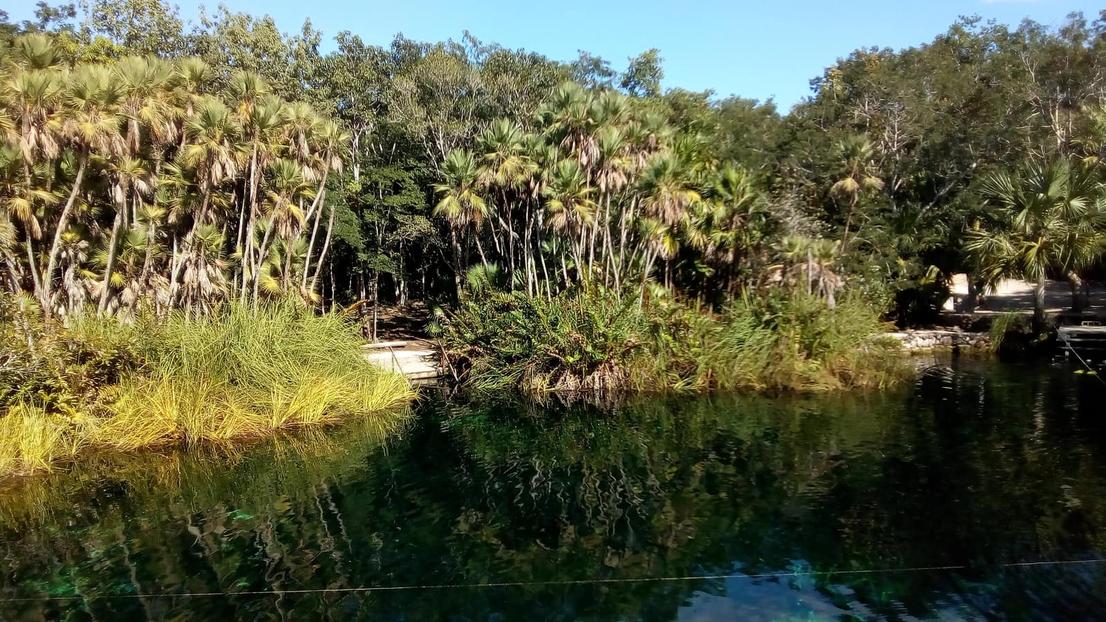
Cool limestone pools open beneath jungle canopy; light shafts cut the water like columns. Evenings move from reef swim to limestone ruins warm with stone.
- Duration
- 8 days
- Effort
- Easy
- Window
- Nov–Apr
$5,200–$7,800
Detail →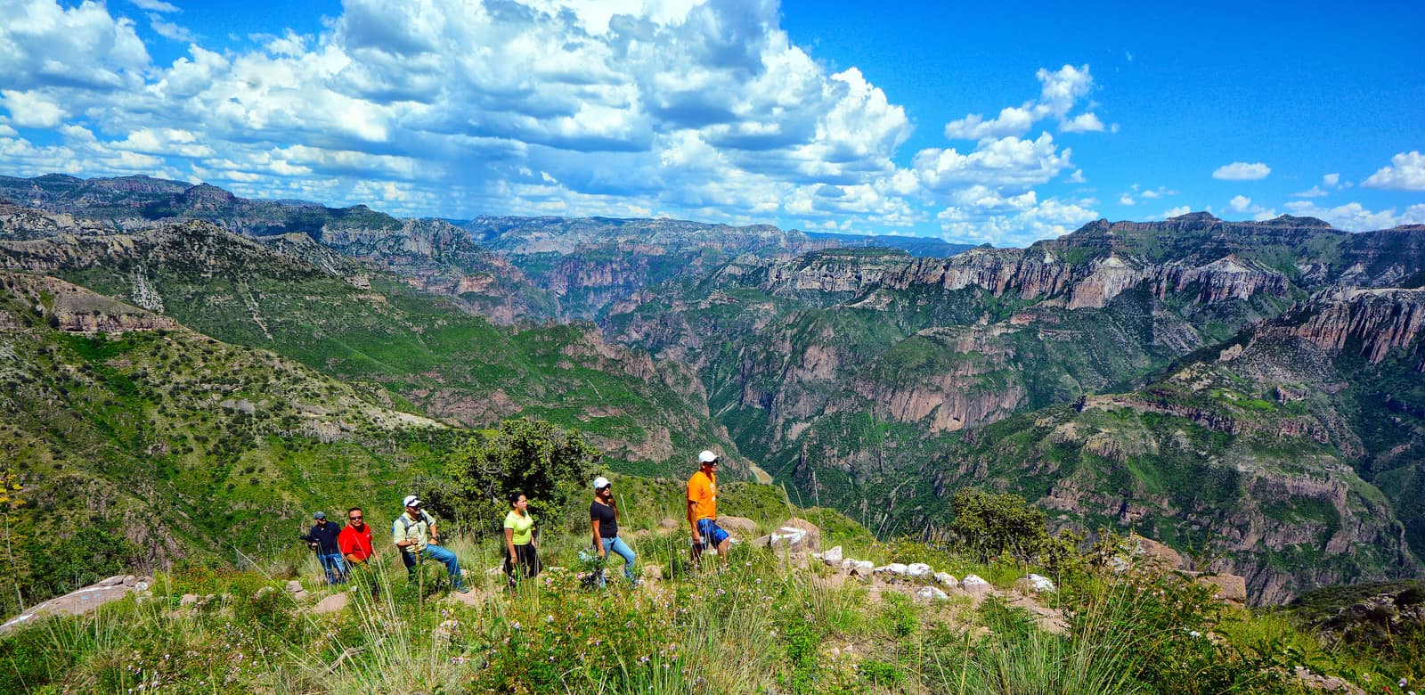
Mexico
Copper Canyon Traverse
Sierra Tarahumara / Barrancas del Cobre (Chihuahua)
Several gorges here run deeper than the Grand Canyon, folded into pine and cliff. Footpaths follow Rarámuri routes where the rim drops away without warning.
- Duration
- 10 days
- Effort
- Challenging
- Window
- Oct–Apr
$6,500–$9,200
Detail →
Mexico
Baja Sea of Cortez Crossing
Loreto to La Paz
Kayak past sea lions on desert islands while whale breath plumes the channel. Camp on beaches where the desert meets deep blue water.
- Duration
- 9 days
- Effort
- Moderate
- Window
- Oct–Nov & Mar–Apr
$7,800–$11,200
Detail →From the ground
Frames from this route family and country — not a studio set, and not a promise of identical weather.