Fitz Roy Circuit
El Chaltén & Los Glaciares
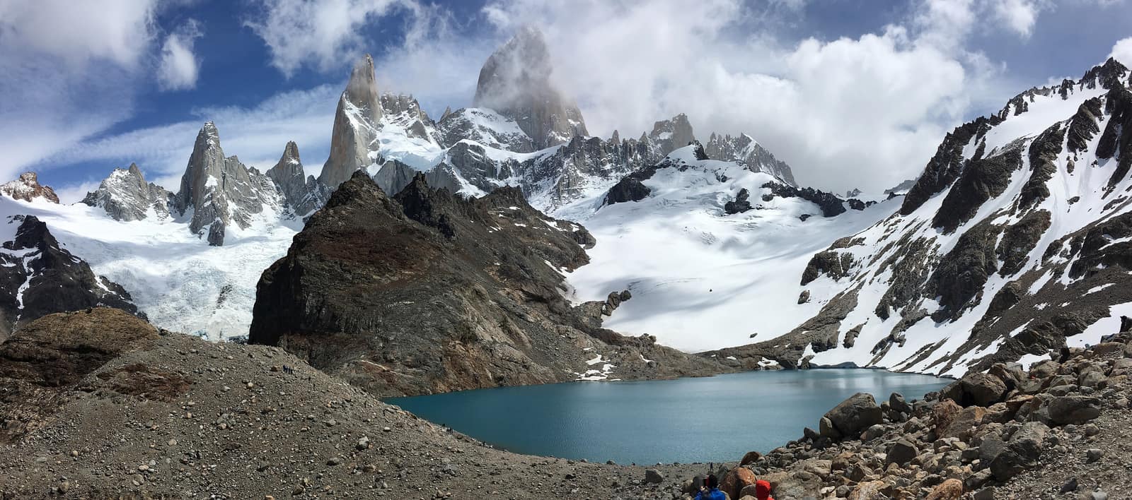
Granite spires catch alpenglow above glacial lakes. Wind funnels the valleys; camps sit under towers that look unfinished by ice.
- Days
- 10
- Effort
- Challenging
- Window
- Nov–Mar
- From
- $8,200
The ground
Cerro Fitz Roy is 3,405 m and Cerro Torre 3,128 m, and the reason they look the way they do is that the Southern Patagonian Icefield sits directly behind them, feeding weather onto granite that has been stripped to bare rock. Fitz Roy's Tehuelche name, Chaltén, means smoking mountain, for the cloud plume that sits on it most days.
El Chaltén is a trailhead town, built in 1985 essentially to establish sovereignty in a border dispute, and everything leaves from the street. No park entry, no shuttle, no gate: you walk out of your hotel onto the trail, which is rare and excellent.
The trekking is non-technical but the days are long and the wind is genuinely the hazard. Laguna de los Tres is 20–25 km round trip with the last kilometre climbing 400 m of steep moraine. The reward is the standard one and it does not disappoint when the cloud lifts.
El Chaltén and Parque Nacional Los Glaciares north, Santa Cruz, Argentina. Working elevation runs El Chaltén 405 m · Laguna de los Tres 1,170 m. That profile shapes sleep, pace, and how early the group needs to move. The published window: November through March. October and April are shoulder, colder, windier, and quieter, with some trails snow-covered. Within that window, day order still flexes with weather and access.
Los Glaciares' northern sector has no entry fee and trails start in town, but registration at the park office is expected and camping is restricted to designated sites. The valley closes trails in extreme wind. Having spare days is the difference between seeing Fitz Roy and photographing cloud. Private guiding, lodge-based in El Chaltén with a flexible day order so we can chase the weather window. Small-group departures up to ten. This is the operating shape of the trip: private enough to reorder days, constrained enough that permits and local rules still set the ceiling.
Shape of the days
A shape, not a script. Order and pacing move with weather, permits, and how the first days actually go.
Day 1
El Calafate to El Chaltén: opening
Day 1 sits inside the 1–2 arc titled El Calafate to El Chaltén. Arrival, the drive up Lago Viedma with the massif ahead, and a shakeout on the Mirador de los Cóndores. This opening slice sets the logistics and the first read of the ground before the denser days. Arrival and orientation use the published access picture. Los Glaciares' northern sector has no entry fee and trails start in town, but registration at the park office is expected and camping is restricted to designated sites. Elevation context for the programme: El Chaltén 405 m · Laguna de los Tres 1,170 m. Sleep and walk length are graded against that, not against a generic fitness brochure. Early days protect the later ones. We do not burn the group on a full-length day before the body has met the altitude, heat, or boat rhythm this route actually uses. El Chaltén is a trailhead town, built in 1985 essentially to establish sovereignty in a border dispute, and everything leaves from the street. No park entry, no shuttle, no gate: you walk out of your hotel onto the trail, which is rare and excellent. Geography stays inside El Chaltén and Parque Nacional Los Glaciares north, Santa Cruz, Argentina. Season logic we plan against: November through March. October and April are shoulder, colder, windier, and quieter, with some trails snow-covered. Packing still matters here: The wind decides your packing: a hard shell that does not flap open, a warm mid layer, gloves, and a hat, in any month.
Day 2
El Calafate to El Chaltén: continuation
Day 2 sits inside the 1–2 arc titled El Calafate to El Chaltén. Arrival, the drive up Lago Viedma with the massif ahead, and a shakeout on the Mirador de los Cóndores. This closing slice of the block consolidates what the earlier days opened, without inventing a new sector. Arrival and orientation use the published access picture. The valley closes trails in extreme wind. Having spare days is the difference between seeing Fitz Roy and photographing cloud. Elevation context for the programme: El Chaltén 405 m · Laguna de los Tres 1,170 m. Sleep and walk length are graded against that, not against a generic fitness brochure. Early days protect the later ones. We do not burn the group on a full-length day before the body has met the altitude, heat, or boat rhythm this route actually uses. No park entry, no shuttle, no gate: you walk out of your hotel onto the trail, which is rare and excellent. Geography stays inside El Chaltén and Parque Nacional Los Glaciares north, Santa Cruz, Argentina. Season logic we plan against: November through March. October and April are shoulder, colder, windier, and quieter, with some trails snow-covered. Packing still matters here: The wind decides your packing: a hard shell that does not flap open, a warm mid layer, gloves, and a hat, in any month.
Days 3–4
The main lines: opening
Days 3–4 continue the The main lines block. Laguna de los Tres for Fitz Roy, Laguna Torre for Cerro Torre and the Grande glacier, and the Piedras Blancas approach. This opening slice sets the logistics and the first read of the ground before the denser days. Field days stay inside the ground already described for Argentina. The trekking is non-technical but the days are long and the wind is genuinely the hazard. Los Glaciares' northern sector has no entry fee and trails start in town, but registration at the park office is expected and camping is restricted to designated sites. Private guiding, lodge-based in El Chaltén with a flexible day order so we can chase the weather window. Expect a full field day measured in hours on foot, on the water, or in transit between sectors already named above. Private guiding means we can shorten or reorder, not that the underlying constraints disappear. Cerro Fitz Roy is 3,405 m and Cerro Torre 3,128 m, and the reason they look the way they do is that the Southern Patagonian Icefield sits directly behind them, feeding weather onto granite that has been stripped to bare rock. Fitz Roy's Tehuelche name, Chaltén, means smoking mountain, for the cloud plume that sits on it most days. Geography stays inside El Chaltén and Parque Nacional Los Glaciares north, Santa Cruz, Argentina. Season logic we plan against: November through March. October and April are shoulder, colder, windier, and quieter, with some trails snow-covered. For kit on these days: The wind decides your packing: a hard shell that does not flap open, a warm mid layer, gloves, and a hat, in any month.
Day 5
The main lines: continuation
Day 5 sits inside the 3–5 arc titled The main lines. Laguna de los Tres for Fitz Roy, Laguna Torre for Cerro Torre and the Grande glacier, and the Piedras Blancas approach. This closing slice of the block consolidates what the earlier days opened, without inventing a new sector. Field days stay inside the ground already described for Argentina. Cerro Fitz Roy is 3,405 m and Cerro Torre 3,128 m, and the reason they look the way they do is that the Southern Patagonian Icefield sits directly behind them, feeding weather onto granite that has been stripped to bare rock. The valley closes trails in extreme wind. Having spare days is the difference between seeing Fitz Roy and photographing cloud. Private guiding, lodge-based in El Chaltén with a flexible day order so we can chase the weather window. Expect a full field day measured in hours on foot, on the water, or in transit between sectors already named above. Private guiding means we can shorten or reorder, not that the underlying constraints disappear. Fitz Roy's Tehuelche name, Chaltén, means smoking mountain, for the cloud plume that sits on it most days. Geography stays inside El Chaltén and Parque Nacional Los Glaciares north, Santa Cruz, Argentina. Season logic we plan against: November through March. October and April are shoulder, colder, windier, and quieter, with some trails snow-covered. For kit on these days: The wind decides your packing: a hard shell that does not flap open, a warm mid layer, gloves, and a hat, in any month.
Day 6
Loma del Pliegue Tumbado: opening
Day 6 sits inside the 6–7 arc titled Loma del Pliegue Tumbado. The best full-massif panorama and the least-walked of the three, plus Chorrillo del Salto and the Río de las Vueltas valley. This opening slice sets the logistics and the first read of the ground before the denser days. Field days stay inside the ground already described for Argentina. El Chaltén is a trailhead town, built in 1985 essentially to establish sovereignty in a border dispute, and everything leaves from the street. Los Glaciares' northern sector has no entry fee and trails start in town, but registration at the park office is expected and camping is restricted to designated sites. Private guiding, lodge-based in El Chaltén with a flexible day order so we can chase the weather window. Expect a full field day measured in hours on foot, on the water, or in transit between sectors already named above. Private guiding means we can shorten or reorder, not that the underlying constraints disappear. The trekking is non-technical but the days are long and the wind is genuinely the hazard. Laguna de los Tres is 20–25 km round trip with the last kilometre climbing 400 m of steep moraine. The reward is the standard one and it does not disappoint when the cloud lifts. Geography stays inside El Chaltén and Parque Nacional Los Glaciares north, Santa Cruz, Argentina. Season logic we plan against: November through March. October and April are shoulder, colder, windier, and quieter, with some trails snow-covered. For kit on these days: The wind decides your packing: a hard shell that does not flap open, a warm mid layer, gloves, and a hat, in any month.
Day 7
Loma del Pliegue Tumbado: continuation
Day 7 sits inside the 6–7 arc titled Loma del Pliegue Tumbado. The best full-massif panorama and the least-walked of the three, plus Chorrillo del Salto and the Río de las Vueltas valley. This closing slice of the block consolidates what the earlier days opened, without inventing a new sector. Field days stay inside the ground already described for Argentina. The trekking is non-technical but the days are long and the wind is genuinely the hazard. The valley closes trails in extreme wind. Having spare days is the difference between seeing Fitz Roy and photographing cloud. Private guiding, lodge-based in El Chaltén with a flexible day order so we can chase the weather window. Expect a full field day measured in hours on foot, on the water, or in transit between sectors already named above. Private guiding means we can shorten or reorder, not that the underlying constraints disappear. Laguna de los Tres is 20–25 km round trip with the last kilometre climbing 400 m of steep moraine. The reward is the standard one and it does not disappoint when the cloud lifts. Geography stays inside El Chaltén and Parque Nacional Los Glaciares north, Santa Cruz, Argentina. Season logic we plan against: November through March. October and April are shoulder, colder, windier, and quieter, with some trails snow-covered. For kit on these days: The wind decides your packing: a hard shell that does not flap open, a warm mid layer, gloves, and a hat, in any month.
Days 8–9
Icefield edge and exit: opening
Days 8–9 continue the Icefield edge and exit block. Optional Paso del Viento toward the icefield or a Viedma glacier ice day, then back to El Calafate. This opening slice sets the logistics and the first read of the ground before the denser days. Exit logistics follow the same transfer pattern already built into the programme. The valley closes trails in extreme wind. Having spare days is the difference between seeing Fitz Roy and photographing cloud. International connections should leave buffer after the last field day; late-evening flights only when the ground day is genuinely short. The last day is deliberately lighter where the catalogue allows it, so extraction does not collide with a hard physical ask. El Chaltén is a trailhead town, built in 1985 essentially to establish sovereignty in a border dispute, and everything leaves from the street. No park entry, no shuttle, no gate: you walk out of your hotel onto the trail, which is rare and excellent. Geography stays inside El Chaltén and Parque Nacional Los Glaciares north, Santa Cruz, Argentina. Season logic we plan against: November through March. October and April are shoulder, colder, windier, and quieter, with some trails snow-covered. Packing still matters here: The wind decides your packing: a hard shell that does not flap open, a warm mid layer, gloves, and a hat, in any month.
Day 10
Icefield edge and exit: continuation
Day 10 sits inside the 8–10 arc titled Icefield edge and exit. Optional Paso del Viento toward the icefield or a Viedma glacier ice day, then back to El Calafate. This closing slice of the block consolidates what the earlier days opened, without inventing a new sector. Exit logistics follow the same transfer pattern already built into the programme. Los Glaciares' northern sector has no entry fee and trails start in town, but registration at the park office is expected and camping is restricted to designated sites. International connections should leave buffer after the last field day; late-evening flights only when the ground day is genuinely short. The last day is deliberately lighter where the catalogue allows it, so extraction does not collide with a hard physical ask. No park entry, no shuttle, no gate: you walk out of your hotel onto the trail, which is rare and excellent. Geography stays inside El Chaltén and Parque Nacional Los Glaciares north, Santa Cruz, Argentina. Season logic we plan against: November through March. October and April are shoulder, colder, windier, and quieter, with some trails snow-covered. Packing still matters here: The wind decides your packing: a hard shell that does not flap open, a warm mid layer, gloves, and a hat, in any month.
Conditions
Low altitude, extreme wind. Summer highs of 10–20 °C and snow possible in any month. The wind on the exposed ridges regularly exceeds 80 km/h and has knocked walkers down. Daylight runs to 22:00 in midsummer, which gives real flexibility to wait for a weather window.
Fitness bar
Challenging. Consecutive days of six to nine hours, 20–25 km, with 700–1,000 m of ascent on moraine and scree, in wind. Non-technical throughout.
Best months
November through March. October and April are shoulder, colder, windier, and quieter, with some trails snow-covered.
Private or small group
Private guiding, lodge-based in El Chaltén with a flexible day order so we can chase the weather window. Small-group departures up to ten.
What to bring
The wind decides your packing: a hard shell that does not flap open, a warm mid layer, gloves, and a hat, in any month. Broken-in boots for 20–25 km days on moraine. Poles for the 400 m of steep moraine to Laguna de los Tres.
Patagonia & Fjords
Access and permits
The constraints that actually decide whether a date is possible.
- Los Glaciares' northern sector has no entry fee and trails start in town, but registration at the park office is expected and camping is restricted to designated sites.
- The valley closes trails in extreme wind. Having spare days is the difference between seeing Fitz Roy and photographing cloud.
Included
- Private mountain guide for all trekking days
- Lodge accommodation in El Chaltén and El Calafate
- All transfers, including the Calafate–Chaltén road legs
- Weather-driven itinerary reordering at no extra cost
- Daily field briefings with the lead guide before departure
Not included
- Technical climbing on Fitz Roy or Cerro Torre, that is a different trip entirely
- Domestic flights
- Ice trekking on Viedma unless added
- Personal insurance, including medical and evacuation cover
- Tips for guides and lodge staff, which remain optional and separate
What the price reflects
$8,200–12,200 for ten days reflects private guiding, the better lodges in a town with limited good beds, and the flexibility to reorder days around weather. El Chaltén is entirely walkable independently and much cheaper if you are content to guess the forecast. What moves a quote inside that picture is party size, season, and the lodge or camp class actually available for your dates. Private guiding, lodge-based in El Chaltén with a flexible day order so we can chase the weather window. Small-group departures up to ten. On the included side, the band already assumes items such as: Private mountain guide for all trekking days; Lodge accommodation in El Chaltén and El Calafate; All transfers, including the Calafate–Chaltén road legs. Still outside the band unless we write them in: Technical climbing on Fitz Roy or Cerro Torre, that is a different trip entirely; Domestic flights; Ice trekking on Viedma unless added. Nothing is confirmed until it is confirmed in writing.
- Party size
- Per-person cost usually falls as the private team is shared across more guests, up to the format limit implied by the guiding and lodge picture. Private guiding, lodge-based in El Chaltén with a flexible day order so we can chase the weather window.
- Season and dates
- Window on the card: Nov–Mar. Planning note: November through March. October and April are shoulder, colder, windier, and quieter, with some trails snow-covered. Peak dates inside that window tighten lodge and permit availability, which is what usually pushes a quote toward the top of a published band.
- Lodge or camp class
- Accommodation in the band reflects: Lodge accommodation in El Chaltén and El Calafate. Moving up or down a class, or shifting to a scarcer property, changes the quote without changing the route.
- Internal transport
- Transfers and regional legs follow the trip design. Watch for: Domestic flights. Charter or peak-season domestic seats, where they apply, sit outside a simple road transfer.
- Permits and access
- Access cost tracks what the ground already requires. Los Glaciares' northern sector has no entry fee and trails start in town, but registration at the park office is expected and camping is restricted to designated sites. We do not invent fee figures beyond what the catalogue already states.
- Outside the band
- Not assumed unless written in: Technical climbing on Fitz Roy or Cerro Torre, that is a different trip entirely; Domestic flights; Ice trekking on Viedma unless added.
Bands are per person sharing and move with party size, season, and lodge choice. Nothing is confirmed until it is confirmed in writing. How we price.
Where this is
El Chaltén and Parque Nacional Los Glaciares north, Santa Cruz, Argentina.
Elevation: El Chaltén 405 m · Laguna de los Tres 1,170 m. Season as published: November–March (trekking season); shoulder Oct/Apr windy/cold. Difficulty as assessed: Challenging.
What we checked
Seasons, altitudes, permits, and caps on this page were checked against park authorities, monitoring agencies, and operators on the ground. Where a fact changes with the year, we say so rather than round it off.
Near this
Same terrain, different week
Chile
Patagonia Edge Circuit
Torres del Paine & Última Esperanza
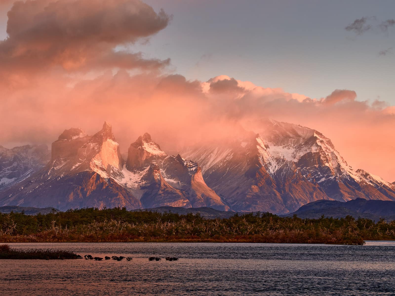
Wind scours granite towers while glacial lakes flash turquoise under fast cloud. Each day closes with firelight and the sound of ice calving far off.
- Duration
- 12 days
- Effort
- Challenging
- Window
- Oct–Apr
$9,500–$18,000
Detail →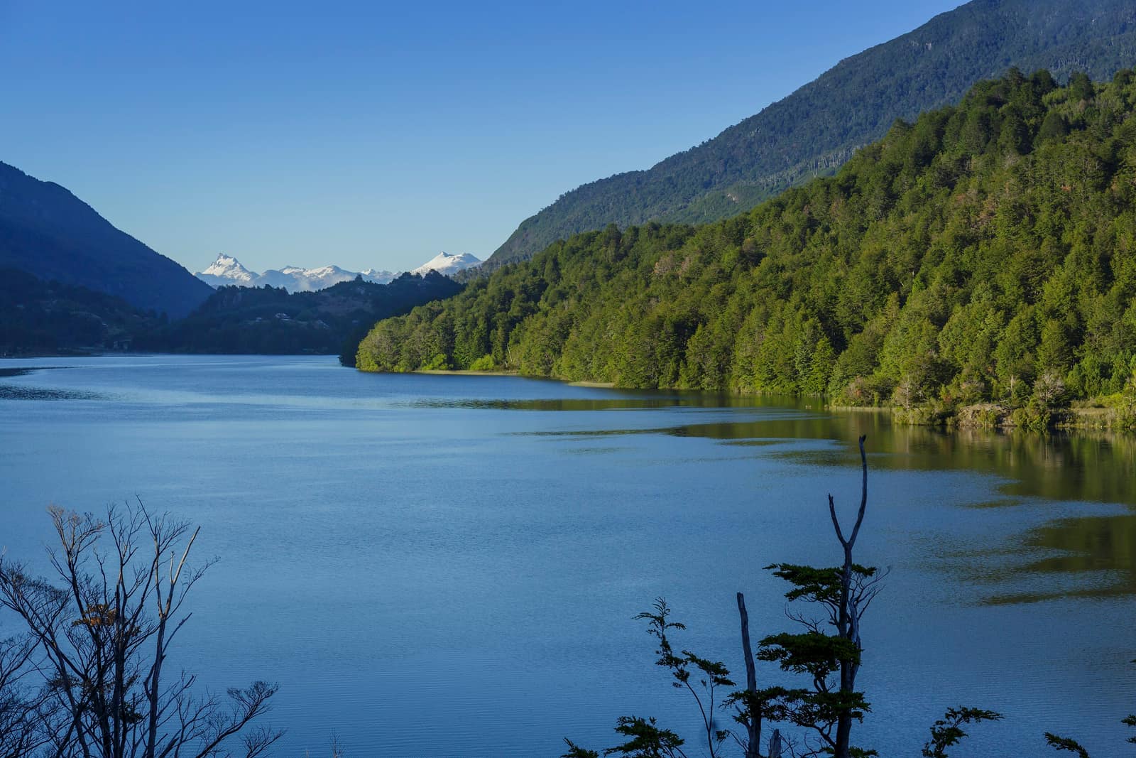
Chile
Carretera Austral Crossing
Región de Aysén, Carretera Austral
Ferry and gravel road through fjords, hanging glaciers, and empty valleys. Marble caves glow turquoise; hot springs steam beside cold rivers.
- Duration
- 12 days
- Effort
- Moderate
- Window
- Nov–Mar
$8,800–$12,800
Detail →
Chile
Chiloé Island Coast
Chiloé Archipelago
Wooden churches face Pacific swell; penguins nest on rocky islets. Mist and peat smell of the south; stilt villages rise with the tide.
- Duration
- 7 days
- Effort
- Easy
- Window
- Oct–Apr
$5,200–$7,900
Detail →From the ground
Frames from this route family and country — not a studio set, and not a promise of identical weather.