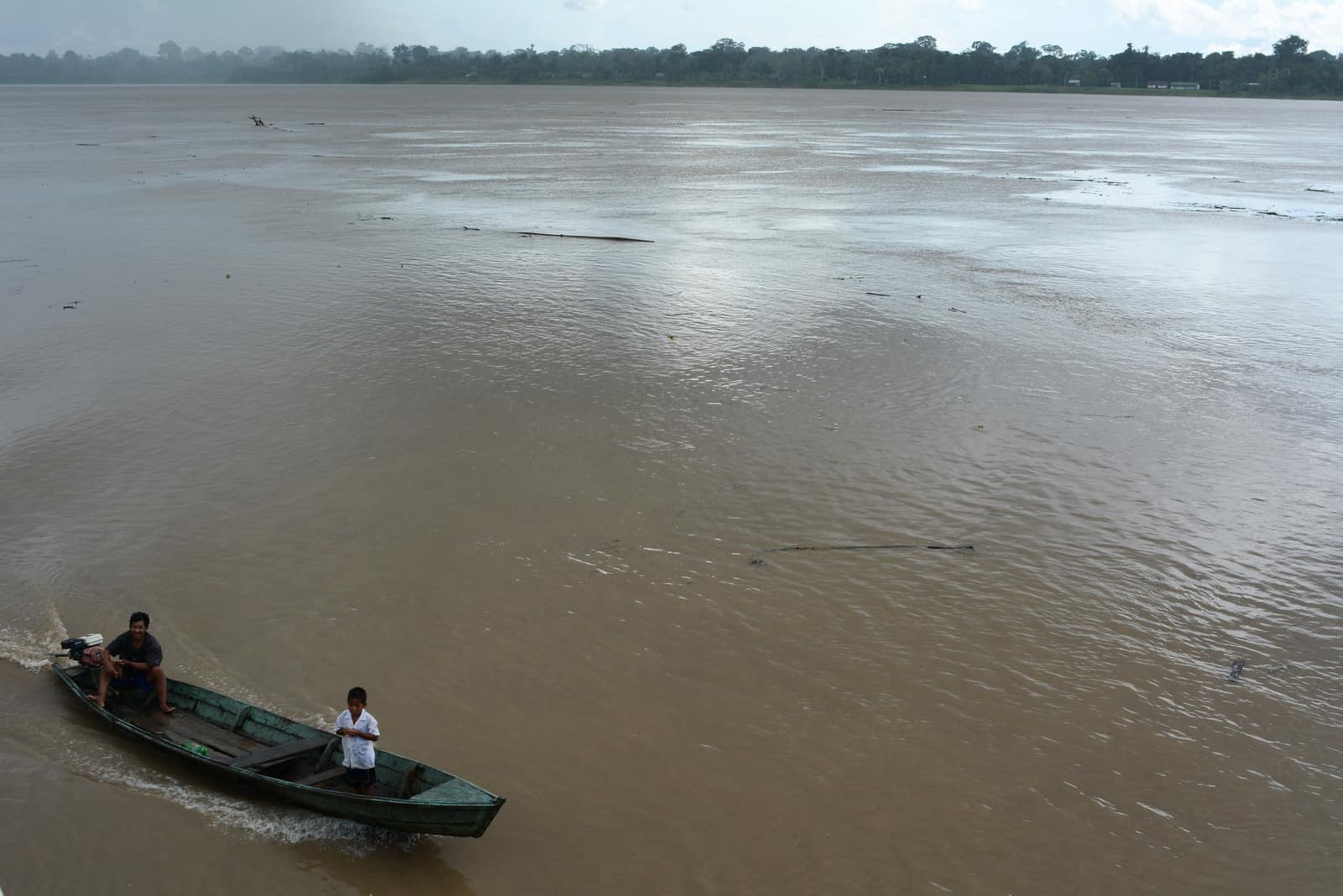
Amazon Putumayo River
Putumayo & Amazon Gateway
Blackwater tributaries cut through primary forest at Colombia's southern edge. Pink river dolphins work the main channels — present, not promised.
By invitation
This one is inquire-only and stays that way. Whether it can run at all turns on a permit cap, a compliance regime, a current security read, or consent held by the community whose ground it crosses. Read the access notes, tell us what you have in mind, and we will give you a straight answer — including no.
- Days
- 9
- Effort
- Moderate
- Window
- By arrangement
- From
- On inquiry
The ground
Two different places get called the same thing, so we separate them. Putumayo is a department on Colombia's Andean-Amazon piedmont. The Amazon gateway most travellers picture, Leticia, the Amacayacu forests, the three-country river frontier, is in Amazonas, several hundred kilometres east. We will tell you which one an itinerary actually uses.
The forest itself is exceptional: blackwater tributaries under primary canopy, Amazonian piedmont birding that mixes Andean and lowland families, and communities with real depth of plant knowledge. Pink river dolphins are present in the main channels and are sometimes seen well; they are not a scheduled event and we will not sell them as one.
This is inquire-only on security grounds. Conditions in parts of Putumayo have varied considerably, and a season label alone is not a responsible answer. Every departure gets a current review and a mandatory brief, and if the picture does not support it we route you to Amazonas instead and say why.
Putumayo department and the Colombian Amazon gateway. These are distinct places and we name which one you are going to. Working elevation runs Lowland Amazon, 100–300 m. That profile shapes sleep, pace, and how early the group needs to move. The published window: Set with the operator against river level and the current security picture, not from a fixed calendar. High water June to August; the security brief is mandatory regardless of month. Within that window, day order still flexes with weather and access.
Check the current advisory for Putumayo before planning; conditions have varied and are department- and municipality-specific. If the corridor does not clear, the Amazonas route out of Leticia is a straightforward alternative and we will offer it rather than stretch the point. Private only, by arrangement, with a vetted operator. No fixed departures. This is the operating shape of the trip: private enough to reorder days, constrained enough that permits and local rules still set the ceiling.
Shape of the days
A shape, not a script. Order and pacing move with weather, permits, and how the first days actually go.
Stage 1
Security screening and brief
Stage 1 covers Security screening and brief. Current advisory and operator review for the specific corridor and dates, with a written brief you read before committing. The day order inside this block can shift when weather or access forces a rewrite. Arrival and orientation use the published access picture. Check the current advisory for Putumayo before planning; conditions have varied and are department- and municipality-specific. Elevation context for the programme: Lowland Amazon, 100–300 m. Sleep and walk length are graded against that, not against a generic fitness brochure. Early days protect the later ones. We do not burn the group on a full-length day before the body has met the altitude, heat, or boat rhythm this route actually uses. The forest itself is exceptional: blackwater tributaries under primary canopy, Amazonian piedmont birding that mixes Andean and lowland families, and communities with real depth of plant knowledge. Pink river dolphins are present in the main channels and are sometimes seen well; they are not a scheduled event and we will not sell them as one. Geography stays inside Putumayo department and the Colombian Amazon gateway. These are distinct places and we name which one you are going to. Season logic we plan against: Set with the operator against river level and the current security picture, not from a fixed calendar. High water June to August; the security brief is mandatory regardless of month. Packing still matters here: Quick-dry long layers, repellent, and a dry bag for river days.
Stage 2
Gateway
Stage 2 covers Gateway. Leticia or a cleared Putumayo gateway, depending on what the review supports. The choice is explicit, not blurred. The day order inside this block can shift when weather or access forces a rewrite. Field days stay inside the ground already described for Colombia. The forest itself is exceptional: blackwater tributaries under primary canopy, Amazonian piedmont birding that mixes Andean and lowland families, and communities with real depth of plant knowledge. If the corridor does not clear, the Amazonas route out of Leticia is a straightforward alternative and we will offer it rather than stretch the point. Private only, by arrangement, with a vetted operator. Expect a full field day measured in hours on foot, on the water, or in transit between sectors already named above. Private guiding means we can shorten or reorder, not that the underlying constraints disappear. This is inquire-only on security grounds. Conditions in parts of Putumayo have varied considerably, and a season label alone is not a responsible answer. Every departure gets a current review and a mandatory brief, and if the picture does not support it we route you to Amazonas instead and say why. Geography stays inside Putumayo department and the Colombian Amazon gateway. These are distinct places and we name which one you are going to. Season logic we plan against: Set with the operator against river level and the current security picture, not from a fixed calendar. High water June to August; the security brief is mandatory regardless of month. For kit on these days: Quick-dry long layers, repellent, and a dry bag for river days.
Stage 3
River days
Stage 3 covers River days. Lodge and river camps on cleared reaches, dawn and dusk boat work, canopy and terra-firme walks with community guides. The day order inside this block can shift when weather or access forces a rewrite. Field days stay inside the ground already described for Colombia. This is inquire-only on security grounds. Check the current advisory for Putumayo before planning; conditions have varied and are department- and municipality-specific. Private only, by arrangement, with a vetted operator. Expect a full field day measured in hours on foot, on the water, or in transit between sectors already named above. Private guiding means we can shorten or reorder, not that the underlying constraints disappear. Two different places get called the same thing, so we separate them. Putumayo is a department on Colombia's Andean-Amazon piedmont. The Amazon gateway most travellers picture, Leticia, the Amacayacu forests, the three-country river frontier, is in Amazonas, several hundred kilometres east. We will tell you which one an itinerary actually uses. Geography stays inside Putumayo department and the Colombian Amazon gateway. These are distinct places and we name which one you are going to. Season logic we plan against: Set with the operator against river level and the current security picture, not from a fixed calendar. High water June to August; the security brief is mandatory regardless of month. For kit on these days: Quick-dry long layers, repellent, and a dry bag for river days.
Stage 4
Community protocols and exit
Stage 4 covers Community protocols and exit. Visits on the communities' own terms and timing, then extraction via the same vetted logistics. The day order inside this block can shift when weather or access forces a rewrite. Exit logistics follow the same transfer pattern already built into the programme. Check the current advisory for Putumayo before planning; conditions have varied and are department- and municipality-specific. International connections should leave buffer after the last field day; late-evening flights only when the ground day is genuinely short. The last day is deliberately lighter where the catalogue allows it, so extraction does not collide with a hard physical ask. The forest itself is exceptional: blackwater tributaries under primary canopy, Amazonian piedmont birding that mixes Andean and lowland families, and communities with real depth of plant knowledge. Pink river dolphins are present in the main channels and are sometimes seen well; they are not a scheduled event and we will not sell them as one. Geography stays inside Putumayo department and the Colombian Amazon gateway. These are distinct places and we name which one you are going to. Season logic we plan against: Set with the operator against river level and the current security picture, not from a fixed calendar. High water June to August; the security brief is mandatory regardless of month. Packing still matters here: Quick-dry long layers, repellent, and a dry bag for river days.
Conditions
Hot and humid year-round. River levels run high roughly June to August, which favours canoe access to flooded forest; lower water opens beaches and terra-firme walking. Rain is possible in any month.
Fitness bar
Moderate. Long boat days, humid flat walking, early starts, and simple accommodation in the deeper reaches.
Best months
Set with the operator against river level and the current security picture, not from a fixed calendar. High water June to August; the security brief is mandatory regardless of month.
Private or small group
Private only, by arrangement, with a vetted operator. No fixed departures.
What to bring
Quick-dry long layers, repellent, and a dry bag for river days. A specific list follows the security brief and the gateway decision, since the two routings pack differently.
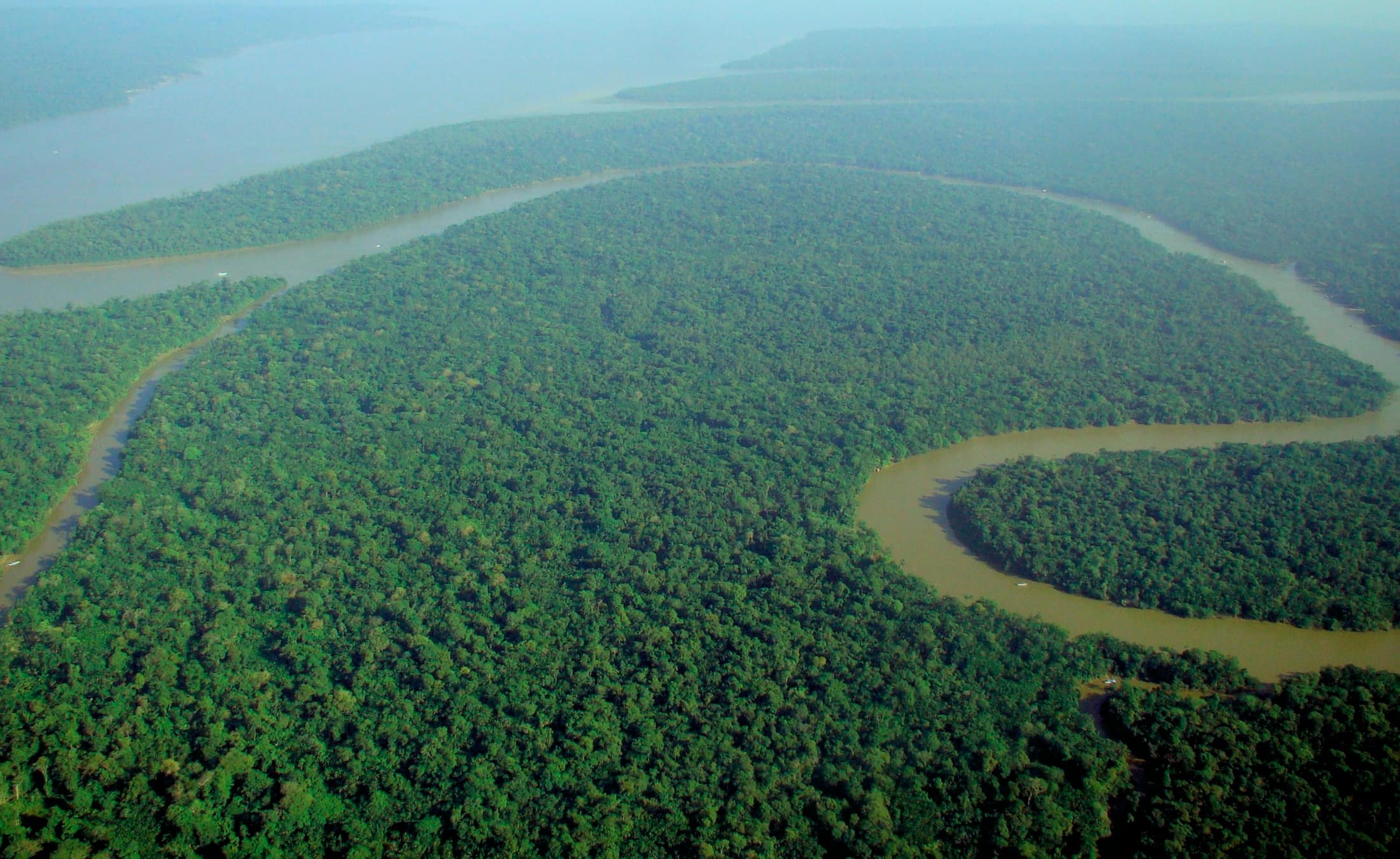
Amazon & Rainforest
Access and permits
The constraints that actually decide whether a date is possible.
- Check the current advisory for Putumayo before planning; conditions have varied and are department- and municipality-specific.
- If the corridor does not clear, the Amazonas route out of Leticia is a straightforward alternative and we will offer it rather than stretch the point.
Included
- Vetted operator, local guides, and all river transport
- Community access agreements and lodge or camp accommodation
- Written security brief and evacuation plan
- Daily field briefings with the lead guide before departure
- Drinking water on active field days
Not included
- Independent travel
- Guaranteed pink river dolphin sightings
- Any corridor not cleared in the current review
- Personal insurance, including medical and evacuation cover
- Tips for guides and lodge staff, which remain optional and separate
What the price reflects
The $6,800–9,800 band is indicative of a nine-day private river programme, and is confirmed only after clearance. If the routing shifts to Amazonas the number moves and we re-quote rather than quietly substitute. What moves a quote inside that picture is party size, season, and the lodge or camp class actually available for your dates. Private only, by arrangement, with a vetted operator. No fixed departures. On the included side, the band already assumes items such as: Vetted operator, local guides, and all river transport; Community access agreements and lodge or camp accommodation; Written security brief and evacuation plan. Still outside the band unless we write them in: Independent travel; Guaranteed pink river dolphin sightings; Any corridor not cleared in the current review. Nothing is confirmed until it is confirmed in writing.
- Party size
- Per-person cost usually falls as the private team is shared across more guests, up to the format limit implied by the guiding and lodge picture. Private only, by arrangement, with a vetted operator.
- Season and dates
- Window on the card: By arrangement. Planning note: Set with the operator against river level and the current security picture, not from a fixed calendar. High water June to August; the security brief is mandatory regardless of month. Peak dates inside that window tighten lodge and permit availability, which is what usually pushes a quote toward the top of a published band.
- Lodge or camp class
- Accommodation in the band reflects: Community access agreements and lodge or camp accommodation. Moving up or down a class, or shifting to a scarcer property, changes the quote without changing the route.
- Internal transport
- Road, boat, and regional air legs are priced from the actual routing for your dates, not from a generic transfer package.
- Permits and access
- Access cost tracks what the ground already requires. Check the current advisory for Putumayo before planning; conditions have varied and are department- and municipality-specific. We do not invent fee figures beyond what the catalogue already states.
- Outside the band
- Not assumed unless written in: Independent travel; Guaranteed pink river dolphin sightings; Any corridor not cleared in the current review.
Bands are per person sharing and move with party size, season, and lodge choice. Nothing is confirmed until it is confirmed in writing. How we price.
Where this is
Putumayo department and the Colombian Amazon gateway. These are distinct places and we name which one you are going to.
Elevation: Lowland Amazon, 100–300 m. Season as published: Coordinate with operator; river levels high Jun–Aug; security brief mandatory. Difficulty as assessed: Moderate.
What we checked
Seasons, altitudes, permits, and caps on this page were checked against park authorities, monitoring agencies, and operators on the ground. Where a fact changes with the year, we say so rather than round it off.
Near this
Same terrain, different week
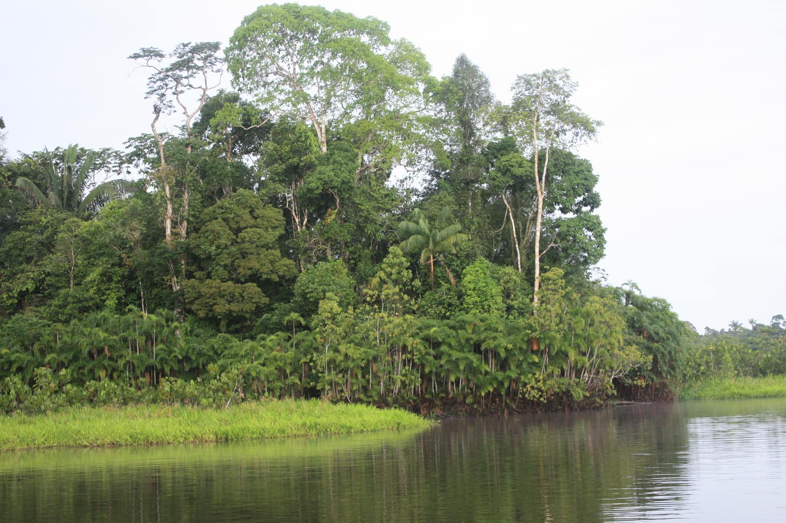
Ecuador
Amazon Canopy & River
Parque Nacional Yasuní & cuenca del Napo
Dawn mist lifts off blackwater channels as howler monkeys claim the canopy. Night walks reveal eyeshine in a forest that never truly sleeps.
- Duration
- 10 days
- Effort
- Moderate
- Window
- Year-round
$7,200–$10,500
Detail →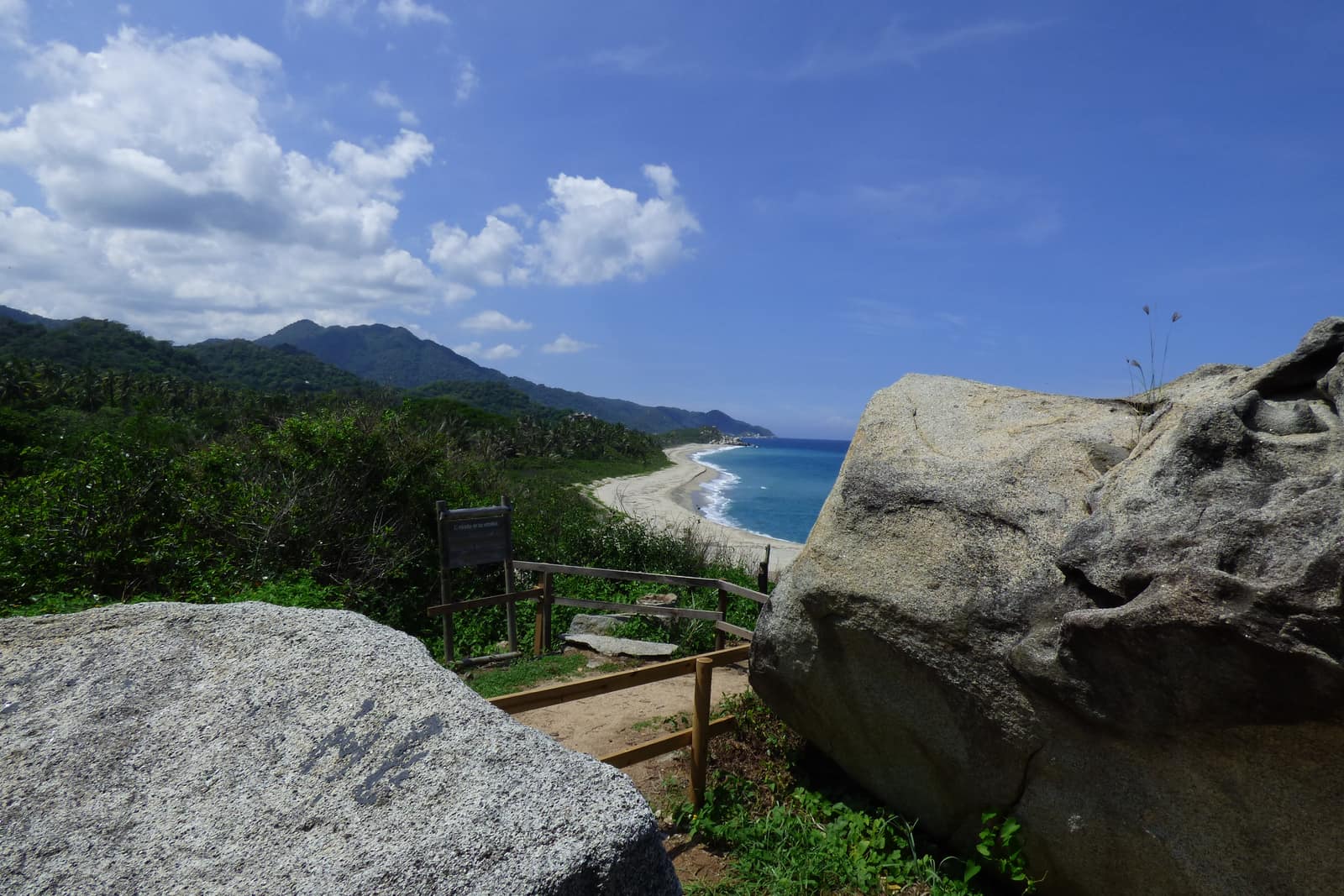
Colombia
Sierra Nevada Caribbean Arc
Sierra Nevada de Santa Marta & Caribbean Coast
Trade winds meet cloud forest on the world's highest coastal range. Authorized mid-elevation trails and Tayrona/Ciudad Perdida corridors—páramo and nevados remain closed sacred territory.
- Duration
- 11 days
- Effort
- Challenging
- Window
- Dec–Mar
$8,500–$12,000
Detail →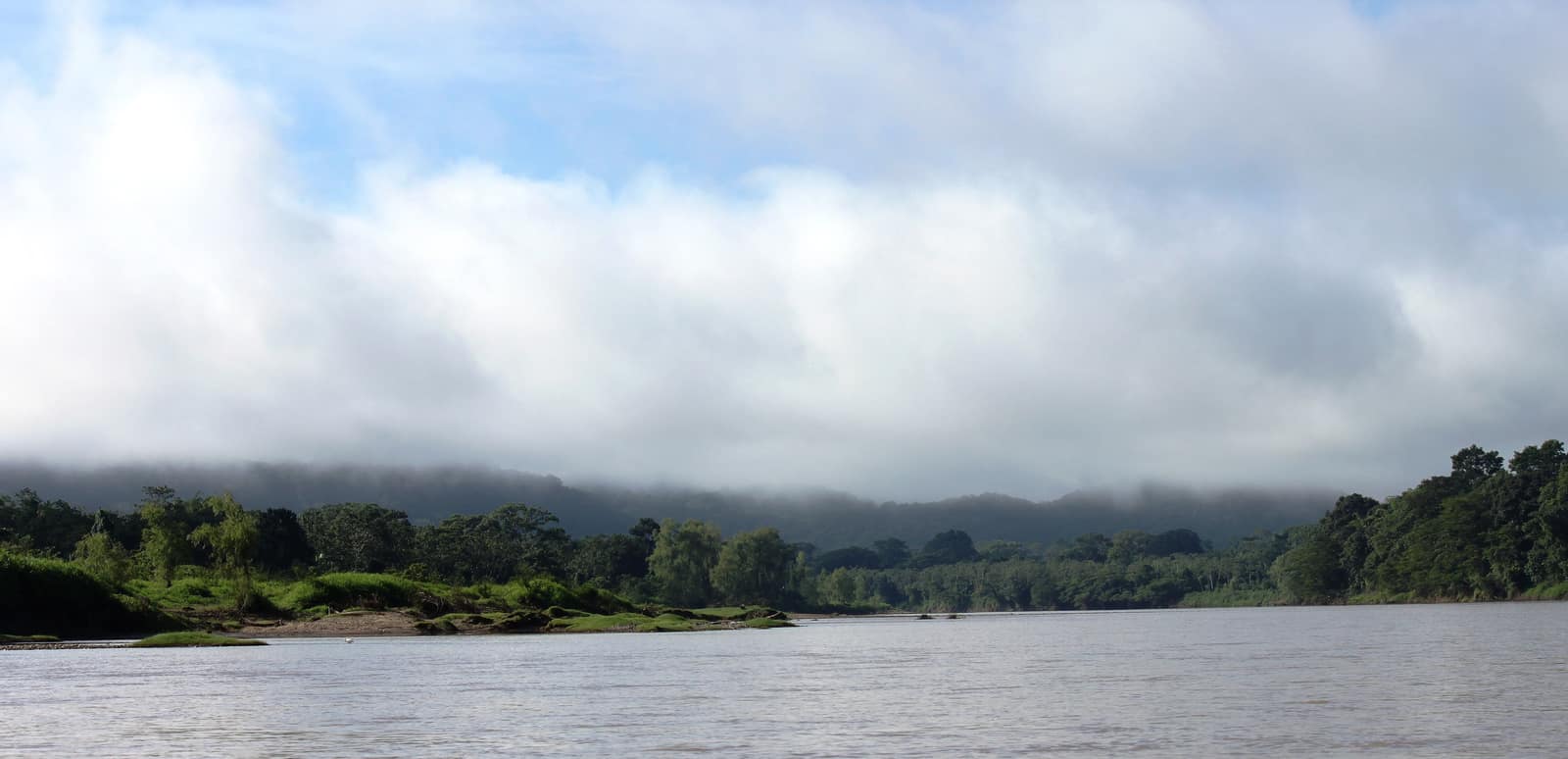
Honduras
By invitation
Mosquitia River Crossing
Río Plátano Biosphere
Only with a pre-vetted Mosquitia operator: river days in Río Plátano Biosphere under community protocols. Not an open itinerary—security screening required.
- Duration
- 12 days
- Effort
- Challenging
- Window
- Feb–May
On inquiry
Access →From the ground
Frames from this route family and country — not a studio set, and not a promise of identical weather.